
ATTOM’s™ School District Boundaries Data
Maps. Districts. Ratings.School District Quality for Prospective Home Buyers
The quality of the local school district is one of the most important factors influencing neighborhood choice among home buyers, according to a recent report from the National Association of Realtors. This factor is especially important to prospective home buyers ages 38 to 52.
Student achievement, class size, funding, and the variety and quality of educational programs and extracurricular activities vary by school district, as do property tax rates. Because of these factors, the value of a home is heavily influenced by the school district it falls within.
As a result, ATTOM School District Boundaries are critical to homeowners, prospective home buyers, investors, and real estate professionals, and are a vital component of real estate search.
ATTOM School District Boundaries for Market Leading Quality
ATTOM School District Boundaries are the premier option for real estate search activity due to to market leading currentness, accuracy, and precision.
The ATTOM GIS Team works throughout the year to identify newly opened school districts, as well as those that have closed, been absorbed, merged, or changed instructional levels or names. Information is collected from federal and state agencies, school district & school board websites, school district administrators, news articles, and feedback from local experts—our network of real estate professionals. Due to these year-round efforts, ATTOM’s School District Boundary data is kept current, while competing products often lag by years.
Additionally, School District Boundaries are examined down to the individual property parcel level by the ATTOM GIS Team to verify assignment and account for new construction, resulting in an unmatched level of quality. ATTOM School District Boundary data covers the entire U.S. and is hand-digitized by GIS Analysts, tracing streets, hydrography, and our nationwide set of parcel boundaries.
To identify the individual schools assigned to a home, see our companion School Attendance Areas product.
How Can You Use ATTOM’s School District Boundaries Data?
Real Estate Portals
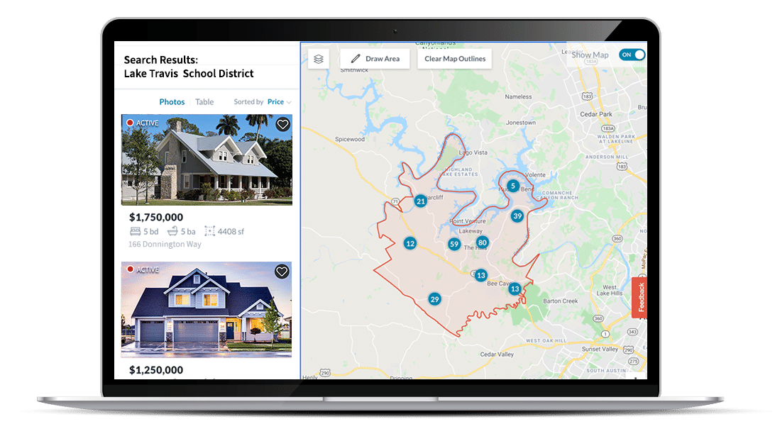
Visitors to property portals can restrict properties to a specific school district in real-time using geospatial filtering, as well as overlay the school district boundary on a map.
Learn More
Real Estate Brokers
Real estate professionals create school district landing pages and property reports showing the school district boundary, name, and separately available ratings, test scores, and reviews.
Learn More
Technology and Data Platforms
Technology and data platforms use School District Boundaries in bulk or via API to tag property records with assigned school district names and related characteristics.
Learn More
Construction Development
Developers view school district boundary maps and ratings and overlay customized datasets to better inform investment decisions and risk assessment.
Learn More
Mortgage
Lenders use school district boundaries and ratings to more accurately value a property. Lending transactions based on an accurate valuation are more likely to reach completion.
Learn More
Government
Learn More
A Variety of Solutions for Your Data Needs
Click here to get in touch with a data expert today and find out how your business can access ATTOM’s comprehensive property data via a variety of flexible formats, such as:
- Cloud Delivery
- ATTOM Nexus
- AI-Ready Solutions
- Property Data APIs
- Bulk Data Licensing
- Property Navigator
- Neighborhood Navigator
- Real Estate Market Reports
- Match & Append
Discover ATTOM and view our Table of Data Elements.


