Geospatial data and analysis are becoming increasingly sophisticated and are serving a broader market. Geospatial data is locational data captured from satellites and aerial imagery presented visually and accurately on maps. Layers of data can be added to visual maps to illustrate land use, demographic information, home values and more, or to... Read More »
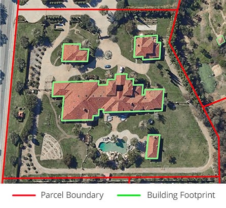
Offers a Detailed National Boundary Product Covering Over 187 Million Building Outlines; Captures the Exact Shape and Perimeter of a Building Using Advanced Proprietary AI Algorithms IRVINE, Calif. — May 28th, 2024 — ATTOM, a leading curator of land, property, and real estate data, is pleased to announce it has added yet another new data product... Read More »
STAY CONNECTED
Sign up for updates on the latest news and upcoming events!