
Location, location, location. The way a home or property is perceived is largely influenced by its location and the surrounding neighborhood. While home buyers or investors may not know exactly what property they want to buy, they often have a clear vision of the type of neighborhood they are seeking. That’s why neighborhood locations and boundaries play a crucial role in property comparisons and classifications.
This guide provides an in-depth look at U.S. neighborhood boundaries — what they are, who uses them, and where you can find neighborhood data.
What are Neighborhood Boundaries?
A neighborhood is a residential area within a boundary. Most neighborhoods have clearly marked borders defined on neighborhood boundary maps or Plat maps. Various industries—such as real estate, urban planning, and investment—rely on this data for zoning, research, and business purposes.
Neighborhood boundaries are typically defined by:
- Streets and roads
- Natural or man-made features (e.g., rivers, parks, highways)
- Land use changes (e.g., residential to commercial or industrial)
- Architectural transitions (e.g., single-family homes to high-rises)
- Historical significance (e.g., historic districts or redeveloped areas)
What Purposes Do Neighborhood Boundaries Serve?
The homes or properties within a neighborhood often have similarities. They might have similar style homes, the properties might have similar footprints, and the demographics might have commonalities, such as neighborhoods with young professionals or families with young children. Thus, neighborhood boundaries are useful data for people looking to buy a home or property based on certain characteristics.
Also, neighborhoods are served by local services and amenities, such as local schools, hospitals, or transit systems. Thus, designating neighborhoods using boundaries makes it easier to analyze and understand the accessibility of an area, its characteristics, and the local services available.
Who Uses Neighborhood Boundaries?
Anyone in any industry that is related to real estate investments, property and land use planning, services industries will have an interest in neighborhood boundary data.
Real Estate Brokers and Agents
A homebuyer’s primary concern is the surrounding neighborhood of their target property. Most real estate agents use neighborhood maps to show the location of a property and the surrounding points of interest such as schools, transportation systems, and shopping centers. Maps can also show neighborhood demographic data, such as average salaries, homeowner characteristics, crime statistics, and weather.
Appraisers
Appraisers and automated valuation models (AVMS) need neighborhood or hyperlocal data to assess a property’s value depending on where it is located. The local schools, crime statistics, amenities, and climate risks all play into a property valuation, and neighborhood boundaries provide a way to separate geographic areas and accurately value the properties within them.
Government Agencies
City planners use neighborhood boundaries to analyze demographics, plan development projects, and set zoning regulations based on specific neighborhood characteristics. Neighborhood boundaries allow researchers to study social issues like education or health disparities within specific geographic areas.
Institutional Investors
Property investors use neighborhood boundary data to compare assets in different neighborhoods. They can base business decisions on market rents, housing inventory and the local market, and the environmental risks.
Marketers
Because neighborhoods typically exhibit similarities regarding factors like demographics or property types within their boundaries, the data can help marketers better target their efforts so that they don’t waste resources and see better results.
Who Defines Neighborhood Boundaries?
Official neighborhood boundaries are determined by city planning departments based on census tracts, streets, and natural boundaries. However, the residents of a neighborhood may use unofficial boundaries such as streets or landmarks.
Where Do You Find Neighborhood Boundaries?
Neighborhood boundaries can be found online from local city planning departments. Neighborhood boundary data are also provided by neighborhood data providers, such as ATTOM, who can customize the data you receive depending on your needs.
ATTOM delivers neighborhood boundary data at four levels:
1. Macro Neighborhoods
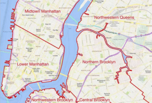
Macro-Neighborhoods are the major sections of a city or large master-planned community
2. Neighborhoods
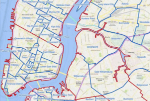
At the neighborhood level, the boundaries are streets, and the different neighborhoods cover the entire area of a city.
3. Sub-Neighborhoods
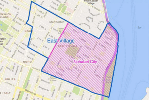
Sub-Neighborhoods are smaller areas, usually within the heart of a city. For example, historic districts, art districts, or business districts are sub-neighborhoods.
4. Residential Subdivisions
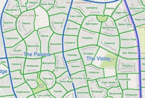
This level of data is subdivisions based on the type of residence. For example, a subdivision might be condominiums, townhomes, apartment complexes, or retirement communities.
These maps are also known as Plat maps. Developers use Plat maps to see where the roads and easements are on public land particularly when a larger tract is being subdivided or when existing properties are being merged into a single property.
Neighborhood Boundaries vs. Parcel Boundaries
A neighborhood boundary is not a parcel boundary. A parcel boundary are the legal lines around the perimeter of a property (property lines) while a neighborhood boundary encompasses several property parcels. Also, neighborhood boundaries can be defined by streets, landmarks, and even by the community perceptions of where a boundary should be. They are not necessarily legally enforced boundaries.
Where to Find Neighborhood Boundaries and Neighborhood Data
Neighborhood data boundaries can be found on mapping apps like Google Maps and from local planning department websites. The research data that corresponds to neighborhoods are provided by the Census Bureau and from real estate data platforms.
Mapping Apps
If you want to find neighborhood boundaries, online maps like Google Maps are useful tools. Google Maps and similar apps show neighborhood names when you zoom in. Some mapping tools allow you to layer data with an option to display the neighborhood boundaries. These mapping tools, however, would not show you specific data for each neighborhood.
Government and Census Data
Your local planning department website will offer official zoning maps that often show neighborhood boundaries. The Census Bureau website provides data by census tracts, which can be used to approximate neighborhood boundaries, and these platforms typically allow you to search their data based on neighborhood characteristics.
Real Estate Platforms
Most real estate listing sites, like Zillow, will offer neighborhood boundaries. They may also provide limited data based on the neighborhood boundaries. For example, they may list the local schools serving the neighborhood and local parks and other amenities.
Remember that neighborhood boundaries may differ depending on the source, and they may also change over time as development occurs.
Contact a Data Expert Now and start using ATTOM’s neighborhood and boundary data.